This map portraying European industrialization in the middle of the nineteenth century indicates a strong geographic connection between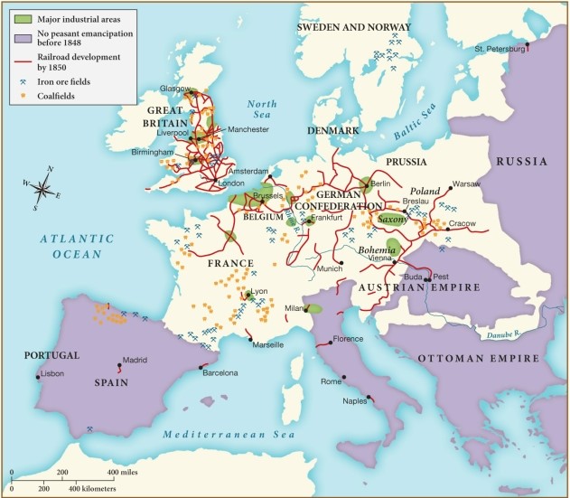
A) railroads and peasant emancipation.
B) industrialization and peasant emancipation.
C) peasant emancipation and coal production.
D) iron manufacture and railroads.
Correct Answer:
Verified
Q17: Which of the following factors contributed to
Q18: What does the "putting-out" system of the
Q19: What was the term used for English
Q20: Beginning in the 1840s, what factory-produced good
Q21: According to this map, which of the
Q23: Between 1800 and 1840, many European countries
Q24: How did peasants in Europe generally respond
Q25: What was the significance of the Factory
Q26: Historians attribute the massive population growth of
Q27: The rapid urbanization that developed as a
Unlock this Answer For Free Now!
View this answer and more for free by performing one of the following actions

Scan the QR code to install the App and get 2 free unlocks

Unlock quizzes for free by uploading documents