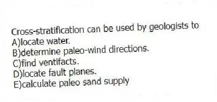
Cross-stratification can be used by geologists to
A) locate water.
B) determine paleo-wind directions.
C) find ventifacts.
D) locate fault planes.
E) calculate paleo sand supply
Correct Answer:
Verified
Q60: Buttes, mesas, and inselbergs represent
A) pinnacles of
Q66: The Persian Gulf War resulted in the
Q73: Desert landscapes tend to be _ in
Q74: On the desert floor,at locally low elevations,an
Q75: The major erosional force in the desert
Q76: Which of the following basin and range
Q77: Which of the following is another name
Q79: The Basin and Range Province was formed
Q82: Which is true of water use on
Q83: Gibber plain,gobi,and serir are regional names for
Unlock this Answer For Free Now!
View this answer and more for free by performing one of the following actions

Scan the QR code to install the App and get 2 free unlocks

Unlock quizzes for free by uploading documents