Questions refer to the maps below.
Russian Expansion, 1801-1914 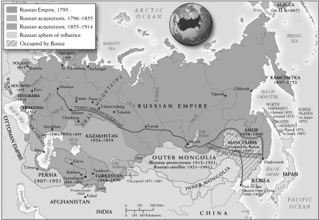 U.S. and Canadian Westward Expansion, 1803-1912
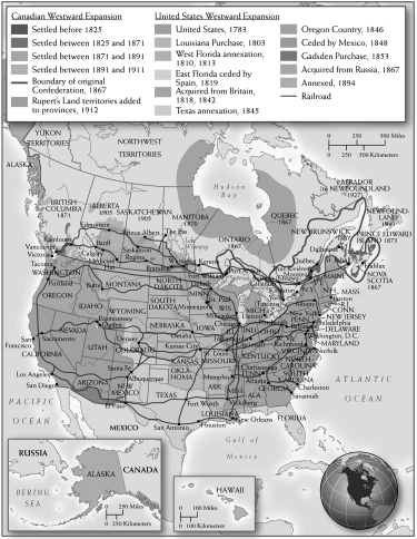
-What can the two maps reveal about the level of industrialization in North America and Russia?
A) They reveal very little, since the maps do not show the location of mines or factories.
B) North America relied on vast natural resources to develop its industrial might.
C) The lack of trade routes implies that both Russia and North America had to be self-reliant.
D) The density of the railway systems implies that Russia was less industrialized than the United States.
Correct Answer:
Verified
Q2: After the Civil War,how did the United
Q11: Which of the following was a method
Q14: Questions refer to the passage below.
"By comparing
Q14: What new economic development permitted the accumulation
Q14: How did the United States' understanding of
Q15: Questions refer to the images below.
The Suez
Q16: Questions refer to the image below.
The Battle
Q17: Which of the following contributed to the
Q18: Questions refer to the maps below.
Russian Expansion,
Q20: Questions refer to the image below.
The Battle
Unlock this Answer For Free Now!
View this answer and more for free by performing one of the following actions

Scan the QR code to install the App and get 2 free unlocks

Unlock quizzes for free by uploading documents