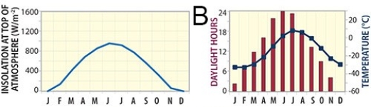
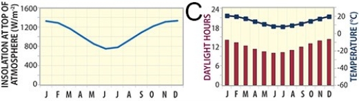
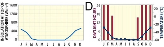
73) Which of these graphs represents a site near the equator, such as near Ecuador?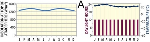
A) A
B) B
C) C
D) D
Correct Answer:
Verified
Q1: 2)In classifying the climate of this imaginary
Q2: 18)Though Khartoum and Urumqi both have dry
Q3: 71)Which of the following sites in South
Q4: 72)Which of the following sites in South
Q6: 136)The Ogallala Aquifer is located:
A)along the Ogallala
Q7: 247)Entrenched meanders represent:
A)stream segments that have been
Q8: 17)The feature in this photograph is a(n):
Q9: 106)In the shorelines investigation, what shoreline feature
Q10: 80)The clay-rich soil pictured below is a
Unlock this Answer For Free Now!
View this answer and more for free by performing one of the following actions

Scan the QR code to install the App and get 2 free unlocks

Unlock quizzes for free by uploading documents