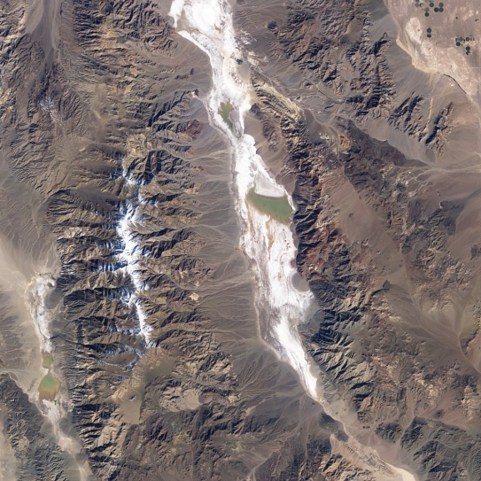
Examine the satellite image of Death Valley, California. (a)What province of the United States is it located within? (b)Identify the various desert landforms seen there, circle and label them, and (c)describe how each one forms. Finally, (d)describe the sequence of events to that produced this scene over time.
Correct Answer:
Verified
View Answer
Unlock this answer now
Get Access to more Verified Answers free of charge
Q46: Desert regions that exhibit a discontinuous pattern
Q47: Between wind, water, and glacial ice, _
Q48: Match the items in the first column
Unlock this Answer For Free Now!
View this answer and more for free by performing one of the following actions

Scan the QR code to install the App and get 2 free unlocks

Unlock quizzes for free by uploading documents