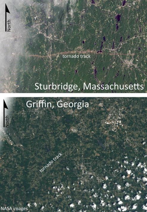
Which of the two tornado tracks shown in these satellite images is typical of the path taken by most tornados in the United States? Explain the "normal" pattern, and suggest a reason for the deviation seen in the other image.
Correct Answer:
Verified
View Answer
Unlock this answer now
Get Access to more Verified Answers free of charge
Q56: Q57: Summarize the factors that lead to the Q58: Describe "Lake effect" snows in the Great Q59: Tornadoes are violent windstorms that take the Q60: _ refers to the situation where a Q61: A hurricane has slower wind speeds than Q62: What does hailstone size indicate about the Unlock this Answer For Free Now! View this answer and more for free by performing one of the following actions Scan the QR code to install the App and get 2 free unlocks Unlock quizzes for free by uploading documents![]()

