The diagram below represents which stage of the U.S.Geological Survey's model of beach erosion? 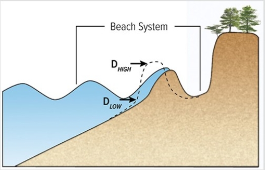
A) Swash regime
B) Collision regime
C) Overwash regime
D) Inundation regime
Correct Answer:
Verified
Q41: The feature pictured below formed as
Q42: What does LIDAR data tell us about
Q43: What happens to the land surface when
Q44: It has been proposed that the reason
Q45: The left to right slope of the
Q47: How does the rate of seafloor spreading
Q48: What is the primary reason an increase
Q49: Which of the following does not affect
Q50: An increase in the rate of seafloor
Q51: What geologic event is probably indicated by
Unlock this Answer For Free Now!
View this answer and more for free by performing one of the following actions

Scan the QR code to install the App and get 2 free unlocks

Unlock quizzes for free by uploading documents