The map below shows zone numbers associated with which coordinate system? 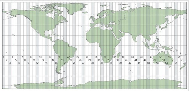
A) Universal Transverse Mercator
B) State Plane Coordinate System
C) Public Land Survey System
Correct Answer:
Verified
Q42: The map below uses what type of
Q43: All map projections introduce at least some
Q44: The Prime Meridian separates
A)great circles from small
Q45: The detailed roads of a very small
Q46: The use of stereopairs is important in
Q48: Which of the following coordinate systems is
Q49: In the Public Land Survey System (PLSS),a
Q50: Which of these types of map projections
Q51: In the State Plane Coordinate System,the rationale
Q52: Maps are secondary data sources when
A)they are
Unlock this Answer For Free Now!
View this answer and more for free by performing one of the following actions

Scan the QR code to install the App and get 2 free unlocks

Unlock quizzes for free by uploading documents