In the map below, the two ice sheets shown are called the 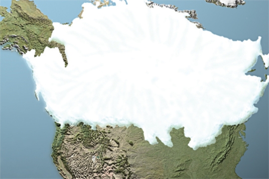
A) Cordilleran in the west and Laurentide in the east.
B) Laurentide in the west and Cordilleran in the east.
C) Yukon in the west and Aftonian in the east.
D) Sangamon in the west and Icelandic in the east.
Correct Answer:
Verified
Q3: What is one reason why the U.S.East
Q7: The circular-shaped mass of ice shown in
Q8: What type of glacier is shown in
Q9: What happens on either side of the
Q13: Which of these areas is believed to
Q14: When the upper surface of the open
Q14: A geographic feature that formed as a
Q15: What type of glacier is shown below
Q16: The exposed bedrock in the background of
Q17: What is the origin of smooth troughs
Unlock this Answer For Free Now!
View this answer and more for free by performing one of the following actions

Scan the QR code to install the App and get 2 free unlocks

Unlock quizzes for free by uploading documents