The map below is showing zone numbers associated with which coordinate system? 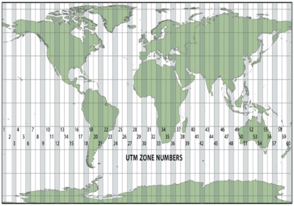
A) Universal Transverse Mercator
B) State Plane Coordinate System
C) Public Land Survey System
Correct Answer:
Verified
Q43: All map projections introduce at least some
Q46: The use of stereopairs is important in
Q51: In the State Plane Coordinate System,the rationale
Q52: Maps are secondary data sources when
A)they are
Q54: On the map below, all of the
Q55: Base maps are useful because they
A)contain no
Q60: In the Public Land Survey System (PLSS),
Q66: The concept of overlay in geographic information
Q70: The purpose of Daylight Savings Time is
Q80: Multispectral remote sensing refers to
A)returning to the
Unlock this Answer For Free Now!
View this answer and more for free by performing one of the following actions

Scan the QR code to install the App and get 2 free unlocks

Unlock quizzes for free by uploading documents